
Photo Archives
"Scenes"
Description
Date Taken
Notes
File No.
Page 2 of 3
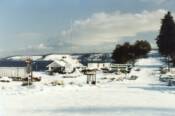
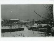
Scenes130
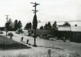
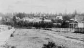
Steilacoom snowed-in
1985
Scenes135
Scenes130
Scenes134
Scenes132
Scenes131
Scenes140
Scenes139
Scenes138
Scenes137
Scenes136
 | ||||||
| ||||||
| ||||||
| ||||||
| ||||||
| ||||||
| ||||||
| ||||||
| ||||||
| ||||||
Scenes142C
Scenes142B
Scenes142A
Scenes142
Scenes141
Scenes143
Scenes144C
Scenes144B
Scenes144A
Scenes145
Photo Missing
Scenes146
Scenes147B
Scenes147A
Scenes150
Scenes149
Scenes148B
Scenes148A
| ||||||
| ||||||
| ||||||
| ||||||
| ||||||
| ||||||
| ||||||
| ||||||
| ||||||
| ||||||
| ||||||
| ||||||
| ||||||
| ||||||
| ||||||
| ||||||
Scenes154B
Scenes153
Scenes154A
Scenes152
Scenes151
Scenes156
Scenes155
Scenes157A
Scenes157D
Scenes157E
Scenes157C
Scenes157B
Scenes158
Scenes162
Scenes161
Scenes160
Scenes159
| ||||||
| ||||||
| ||||||
| ||||||
| ||||||
| ||||||
| ||||||
| ||||||
| ||||||
| ||||||
| ||||||
| ||||||
| ||||||
| ||||||
| ||||||
| ||||||
| ||||||
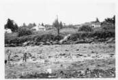
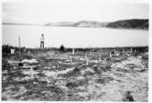
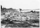
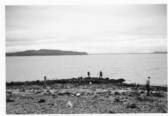
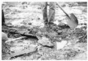
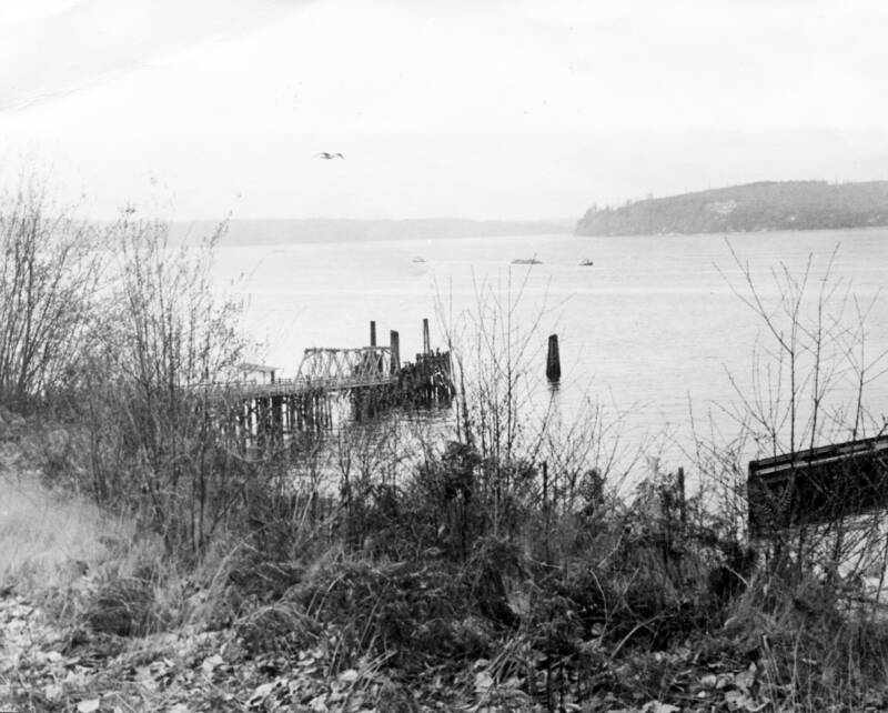
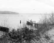
Low tide at site of Balch Wharf
Balch Wharf pilings. Wharf had been built in 1851/2.
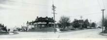
Steilacoom center, Bair store
1978
Unk
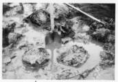
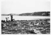
Balch Wharf area at low tide
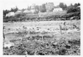
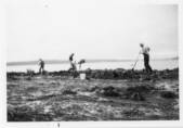
Jennifer Trish Laughlin, Lynn Scholes, Rob and Nancy Hellyer at the pilings of old Balch Wharf during low tide (a very rare minus-4)
Joan and Amy Curtis checking out low tide
Balch Wharf area at low tide
Balch Wharf area at low tide
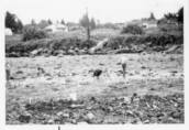
Balch Wharf area at low tide
Balch Wharf area at low tide
Balch Wharf area at low tide
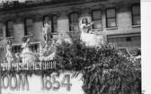
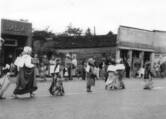
Steilacoom Centennial parade
1954
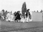
Steilacoom Centennial parade
Steilacoom Centennial parade
Steilacoom Centennial parade
1954
1954
1954
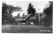
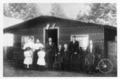
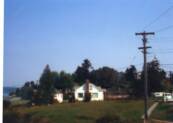
Bergstrom family in front of home in DuPont
Company housing at DuPont
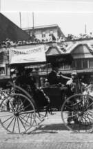
Steilacoom Centennial parade, Glenn Orr in old fashioned buggy
1917
1954
1917
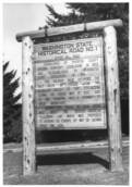
Washington State Historical Road #1 sign originally at intersection of Lafayette and Union (no longer there)
Large oak fallen at site of old Byrd School
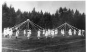
May Day celebration (May poles) at DuPont
1940
1916
1917
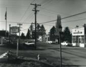
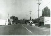
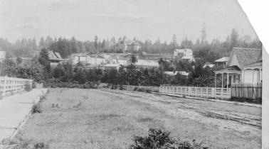
Lafayette Street
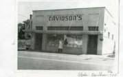
Davidson's store on Lafayette Street
Lafayette Street, Davidson's Store at right.
1950s
1944
1944
Lafayette Street
Commercial Street showing Keach House, Bakery, two women
Looking up Main Street in the block between Lafayette and Rainier Streets
1950
1900
1950s
1900
~1920
1940s
On Wilkes Street looking northwest at Waverly Hotel, Bell Monumnet, Balch house, old Masonic Hall
Snow scene looking toward Lafayette Street, Bair store, monument, old Masonic Hall, Granny bligh's house
Looking up Main Street from Fafayette. Large tree is in front of Orr Wagon Shop. Essentially same view as Scenes150.
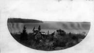
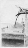
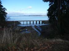
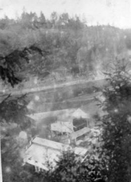
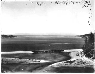
Chambers Creek Bay (trestle is off photo to left, paper mill off photo to right)
Corner of First Street and Champion at Saltar's Point
Unk
Sep 19, 1965
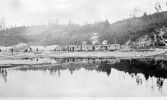
Marina and WPA cook shack at Saltar's Point
Unk
Sep 19, 1965
1920s
Marina and WPA cook shack at Saltar's Point
Fort Nisqually, established in 1933 by Hudson Bay Company, abandoned in 1850s
Silver Beach gravel works just north of Sunnyside Beach, operated by Thompson's Steilacoom Sand and Gravel Co.
1922-23
1920s
Federal Penetentiary at McNeil Island
1922-23
1922-23
Unk
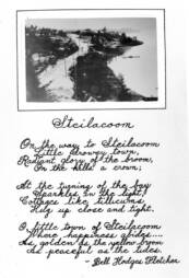
Lafayette Street entering town from north, poem by Bell Hodges Fletcher
Houses in Old Tacoma
View of Commercial Street looking northeasterly from intersection with Martin Street
Unk
Unk
1895
Bottom (north end) of Commercial Street
Unk
Unk
Scenes163
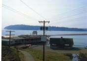
2 possibilities: (1) Dock (ferry?) at water front on north side of Chambers Creek. Fox Island in the nearer background. (2) Photo is reversed and it is the Steilacoom Ferry dock with Anderson Island in background (see reversed photo at right)
Unk
| ||||||
| ||||||
1978
1978
1978
1978
1978
1978
1978
1978
1978
From Davidson Collection
From Davidson Collection
From Davidson Collection
From Davidson Collection
Silver Beach gravel works just north of Sunnyside Beach, operated by Thompson's Steilacoom Sand and Gravel Co.
Silver Beach gravel works just north of Sunnyside Beach, operated by Thompson's Steilacoom Sand and Gravel Co.
Silver Beach gravel works just north of Sunnyside Beach, operated by Thompson's Steilacoom Sand and Gravel Co.
Silver Beach gravel works just north of Sunnyside Beach, operated by Thompson's Steilacoom Sand and Gravel Co.
Scenes165
Scenes167
Scenes164
| ||||||
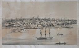
Lithograph of Steilacoom waterfront
| ||||||
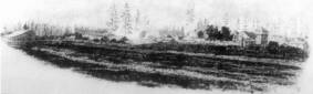
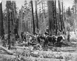
Logging operation (skidding logs with oxen team) near Steilacoom. Photo from collection of Hattie Bair.
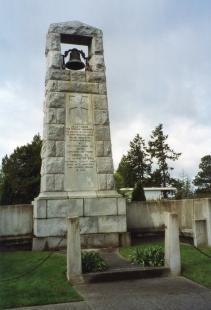
Monument near site of first Steilacoom school
Scenes169
Scenes168
About 1920
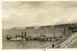
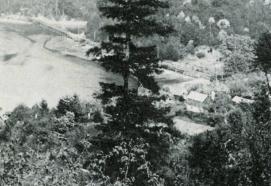
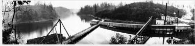
Steilacoom dock and train depot
| ||||||
| ||||||
| ||||||
Scenes170
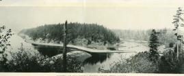
Early view of Steilacoom dock
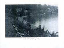
Railroad tracks going by Sunnyside Beach and continuing southbound along waterfront
| ||||||
From Davidson Collection
Scenes172
Scenes171
| ||||||
Railroad tracks going by mouth of 5th Street Waterway. McNeil Island in background.
| ||||||
Postcard showing mouth of Chambers Creek, looking north
Scenes175
Scenes174
Scenes173
| ||||||
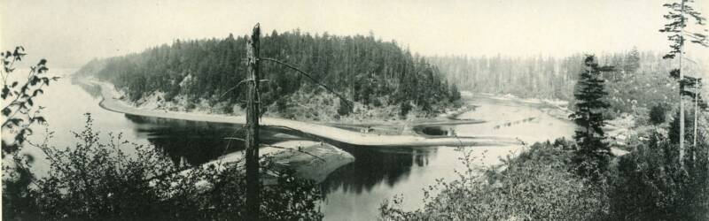
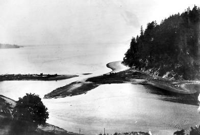
Early photo of Chambers Bay at low tide showing trolley track trestle going across mouth of creek (Garrison Creek?) that was later channeled underground and the area filled in. Later, a paper mill was built on the filled-in land. Thomas Chambers' sawmill may have been at the head of the creek canyon, and may have used the water power of the creek to operate his saws.
| ||||||
Close up of spit partially blocking mouth of Chambers Creek, just as it does today. This photo is probably clipped from the same photo used to produce the postcard in Scenes172.
Scenes177
Scenes176

| ||||||
Boat entering Chambers Bay under railway bridge. Olympic Mountains in background.
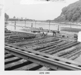
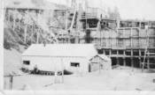
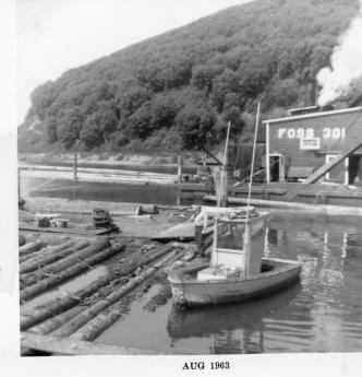
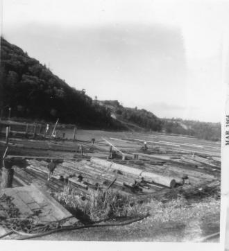
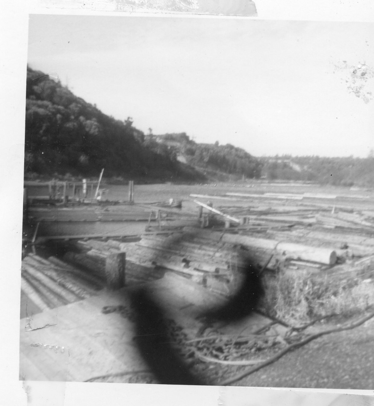
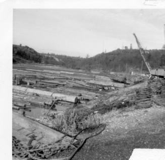
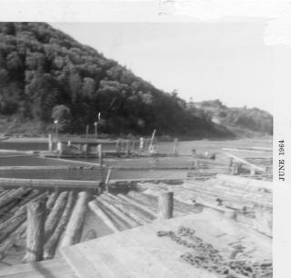
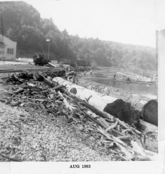
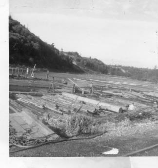
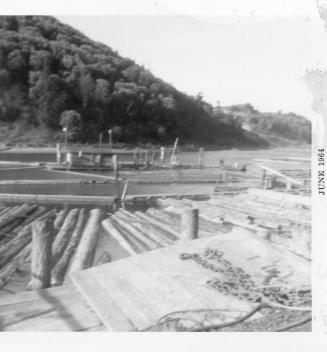
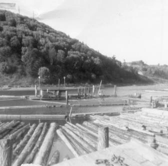
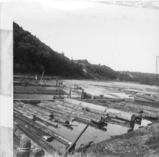
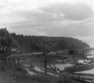
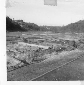
Workers tending floating logs headed for West Tacoma Newsprint mill which was behind the photographer. View is toward mouth of Chambers Creek (note railroad bridge in the distance). Scenes176 through Scenes189 were donated to SHMA in 2010 by Gloria and Paul Miller, decendents of Paul Miller who worked at the mill in 1963. Boise Cascade bought the mill and later sold it to Abitibi Consolidated who closed the mill in 2000. Demolition of the mill in preparation for lease or sale of the land began in 2010.
Aug 1963
| ||||||
| ||||||
Scenes180
Scenes179
Scenes178
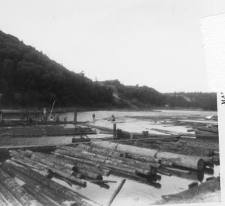
See description for Scenes176 above. Note the floating Foss engine used in support of the newsprint facility.
Aug 1963
Aug 1963
See description for Scenes176 above. This view is looking northeast toward present day University Place.
| ||||||
See description for Scenes176 above. This view is looking northeast toward present day University Place.
Aug 1963
| ||||||
See description for Scenes176 above. This view is looking northeast toward present day University Place.
See description for Scenes176 above. This view is looking northeast toward present day University Place.
Aug 1963
Aug 1963
| ||||||
Scenes181
| ||||||
Scenes184
Scenes183
Scenes182
See description for Scenes176 above. This view is looking northeast toward present day University Place. Inscription on back says "West Tacoma Newsprint [where] Grandpa Paul Miller worked."
See description for Scenes176 above. This view is looking southwest toward Steilacoom.
Aug 1963
Aug 1963
| ||||||
See description for Scenes176 above. This view is looking northeast toward present day University Place.
See description for Scenes176 above. This view is looking northeast toward present day University Place.
Aug 1963
Aug 1963
| ||||||
| ||||||
Scenes186
Scenes187
Scenes185
See description for Scenes176 above. This view is looking southwest toward present day University Place. Inscription on back says "Paul and mill...not too good", the latter refering to the quality of the photo.
See description for Scenes176 above. This view is looking northeast toward present day University Place.
See description for Scenes176 above. This view is looking northeast toward present day University Place.
See description for Scenes176 above. This view is looking northeast toward present day University Place.
Aug 1963
Aug 1963
| ||||||
| ||||||
| ||||||
Scenes189
Scenes188
Aug 1963
Aug 1963
| ||||||
| ||||||
Scenes192
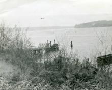
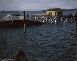
Ferry ramp at Steilacoom dock after damage by severe winds.
| ||||||
Martin Street looking northeast. School is in far background.
Same as Hoff154. Originally thought to be Kennedy's Camp on Chambers Bay, but could also be south shore of Chambers Bay in vicinity of current (2011) Steilacoom Marina.
Scenes190
Scenes191
| ||||||
| ||||||
Scenes194
Scenes193
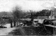
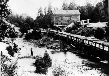
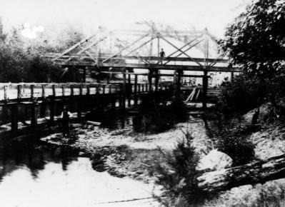
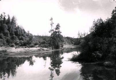
Headwaters of Chambers Creek looking south and showing the Byrd Mill sluice at left. and man standing on the Byrd's MIll Road (currently Steilacoom Boulevard) bridge. Difficult to see toward the lower left corner is a man fishing in the creek. Photo from collection of Joe Johnson, Lakewood, WA.
Headwaters of Chambers Creek looking north and showing Byrd's Mill and water sluice that powered it. Photos was taken from Byrd's Mill Road (now Steilacoom Boulevard) bridge over the creek headwaters. Chambers Creek was known as Steilacoom River at the time. Photo from collection of Joe Johnson, Lakewood, WA.s
Scenes195
Scenes196
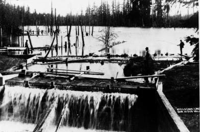
Lake Steilacoom dam with lake in background. Caption at lower right sayes "Steilocome Lake dam at old mill", the "mill" being Byrd's lumber mill which is behind the photographer and downstream. Dead trees in the lake, typical during the early yeas of manmade lakes, have long since disappeared. Photo from collection of Joe Johnson, Lakewood, WA.
| ||||||
| ||||||
| ||||||
| ||||||
Scenes200
Scenes199
Scenes198
Scenes197
| ||||||
| ||||||
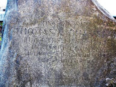
Memorial stone marking general area in which Thomas Chambers built his home, a gristmill, and a lumber mill on Chambers Bay at the mouth of the creek bearing his name.
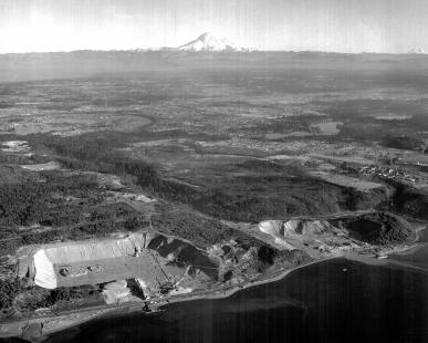
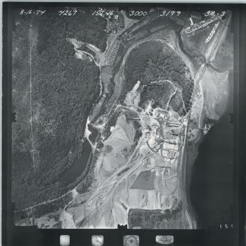
Sand and gravel mine (in University Place) with part of Steilacoom in near background and Mt. Rainier in far background. Magnification of the photo also shows the Cascade Paper Company mill on Chambers Bay with an unnatural-appearing hillside to its northeast. That hill was sluiced to fill in the Garrison Creek Bay providing a foundation for the paper mill. The creek was channeled underground. Photo courtesy of Pierce County Public Works.
April 2011
1963
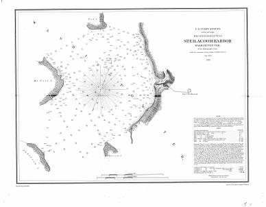
U.S. Coastal Survey chart of "Steilacoom Harbor" and surrounding area as charted in 1856. Chart courtesy of Pierce County Department of Public Works.
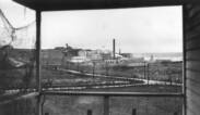
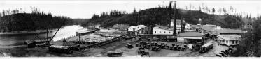
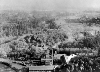
Cascade Paper Company mill on Chambers Bay. Although photo shows little detail as displayed here, the digital file is high resolution allow zooming in the reveal details. Photo courtesy of Pierce County Department of Public Works.
1856
| ||||||
Scenes202
Scenes201
1920
| ||||||
| ||||||
Cascade Paper Company mill on Chambers Bay. Although photo shows little detail as displayed here, the digital file is high resolution allow zooming in the reveal details. Photo courtesy of Pierce County Department of Public Works.
1926
| ||||||
Cropped and magnified version of Scenes 201 immediately above to show Tacoma Streetcar and Power company bridge over headwater of Garrison Creek. Streetcar line initially terminated at Fort Steialcoom (to the right in this photo, and eventually was continued down what is now Steilacoom Boulevard to downtown Steilacoom. Photo courtesy of Pierce County Department of Public Works.
Scenes205
Scenes203
Scenes204
| ||||||
1926
pre-1914
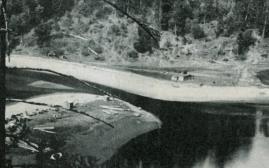
Mouth of Chambers Creek prior to construction of railroad bridge. The spit starting a middle-left of the photo still exists being used for the foundation of the Steilacoom Marina. The long spit originating from the right is much shorter now (2011). It was probably dredged when Cascade Paper built their Mill just off camera to the lower right. Photo courtesy of Pierce County Department of Public Works.
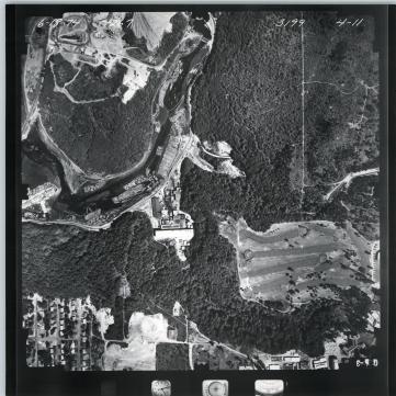
Chambers Bay as seen at high tide. Photo was taken near the site of the current Chambers Creek Road bridge by the dam, looking generally south. The cleared area at left might have been the former site of Thomas Chambers' home. Earlier photos show a home in the same spot. Photo courtesy of Pierce County Department of Public Works.
| ||||||
1913
Mouth of Chambers Bay after construction of the Northern Pacific Railroad and partially completed bridge. Magnification of the photo shows the remains of an enclosed area on the spit orginating from the right. Archeological digs at the site and on other places on the right shore indicate this was an important gathering place for Native Americans for the past hundreds of years. The purpose of the enclosure, erected by white settlers, is unknown. Photo courtesy of Pierce County Department of Public Works.
| ||||||
1914
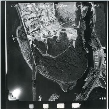
Scenes207
Scenes206
Aerial shot of the Cascade Paper Company mill. The photo is of poor quality, but close inpsection after zooming in shows Mt. Rainer in the upper right corner. The flat area taking up the upper right quadrant of the photo would become the Oakdale development in Lakewood. Just to the left of the top of the mill smoke stack are the mill water towers mill. The Tacoma Streetcar and Power rail line ran past those water towers along a trace to the right than can be scene in the photo, leading to the bridge in Scenes202. That trace is still visible today (2011) when not obscured by foilage. Photo courtesy of Pierce County Department of Public Works.
Unk
| ||||||
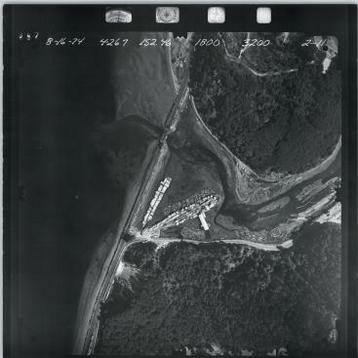
Aerial shot of the mouth of Chambers Creek and it bay. The photo is very high resolution and zooming in reveals logs floating in Chambers Bay (at right) waiting to be processed either at the Boise Cascade Paper mill or the Tacoma Narrows Lumber Company located on the spit running diagonally across the center of the photo. Boat houses are shown just to the left of Lumber Company. Historical records have failed to reveal the location of Thomas Chambers' lumber mill, but it is possible if not very likely that it was at the same site as the Tacoma Narrows mill shown here, given the site's access to ships anchored off shore. Photo courtesy of Pierce County Department of Public Works.
| ||||||
Scenes210
Scenes209
Scenes208
Aug 1974
Aug 1974
Jun 1974
Aug 1974
Closeup view of lumber mill in Scenes207.
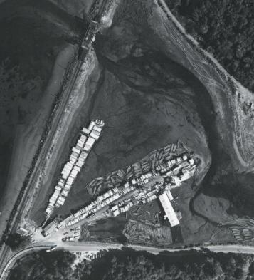
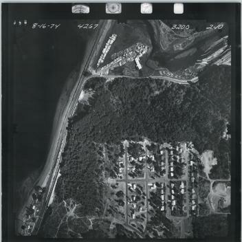
Aerial view of Chambers Bay, Sunnyside Beach, and "upper" Steilacoom. Photo courtesy of Pierce County Department of Public Works.
| ||||||
| ||||||
Scenes212
Scenes211
Aerial view of Chambers Bay and the surrounding area. Photo courtesy of Pierce County Department of Public Works.
| ||||||
Jun 1974
Jun 1974
Jun 1974
Aerial view of Chambers Bay and the surrounding area. Shows "upper" Steilacoom, golf course, and fish hatchery. The latter is at lower left, just above and to the right of the Steilacoom housing development. A road appears to be following the ridgeline to the north from the fish hatchery, and then cutting sharply to the left just before it hits Chambers Bay. Traces of that road are still visible (1911). Photo courtesy of Pierce County Department of Public Works.
Scenes213
| ||||||
Aerial view of Chambers Bay and the surrounding area. Photo courtesy of Pierce County Department of Public Works.

Aerial view of Chambers Bay and the surrounding area. Photo courtesy of Pierce County Department of Public Works.
| ||||||
| ||||||
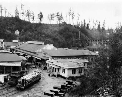
The front part of the Cascade Paper Company mill facing Chambers Creek bay.